Payments
Oregon Nisei Veterans WWII Memorial Highway
Posted on: August 19th, 2025 in Historical Marker Details |
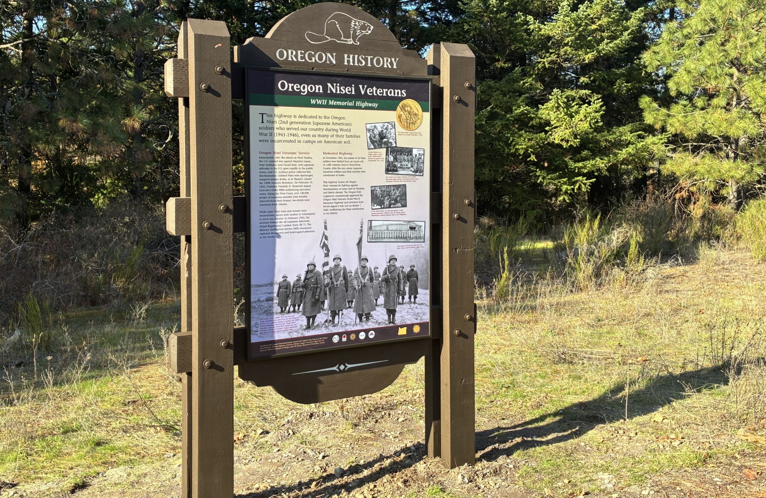
This highway is dedicated to the Oregon Nisei (2nd generation Japanese American) soldiers who served our country during World War II (1941-1946), even as many of their families were incarcerated in camps on American soil.
Oregon Nisei Veterans’ ServiceImmediately after the attack on Pearl Harbor, the U.S. entered war against Imperial Japan, Nazi Germany, and Fascist Italy. Anti-Japanese attitudes in the U.S. grew rapidly in the public arena, and U.S. military …