Payments
OTE Statewide Heritage Tree Dedication
Posted on: April 1st, 2015 in News & Press |
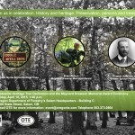
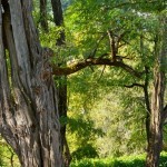
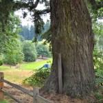
Of trees, fire and shade: Oregon’s Class of 2015 Heritage Trees to be honored
Oregon Travel Experience and its volunteer Oregon Heritage Tree Committee invite the public to participate in the 2015 Statewide Heritage Tree Dedication and the Maynard Drawson Memorial Award ceremony. The free event will be held on April 10, 2015 at 1:00 p.m. at the Oregon Department of Forestry’s (ODF) Salem headquarters at 2600 State St., Building C.
This …