 Payments
Summer travels and Oregon rest areas
Posted on: June 1st, 2016 in News & Press |
Gear up for fun on Oregon roadways

We thought it might be easier to plan your Oregon road-trip if you know what our most common rest area amenities are and what to look for when you stop. You’ll find all that information and more, including traffic updates, below.
Amenities
Among some of the more unusual features at Oregon rest areas to be found are:
- Horse corrals
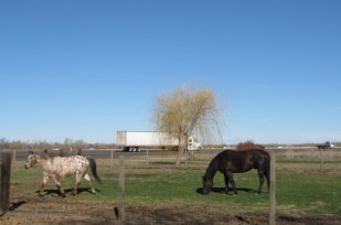 On your way to Idaho in search of famous potatoes or lakes? Taking more than just the family pet? Well Stanfield Rest Area eastbound on I-84 (at Milepost 187) features a horse corral. It’s a good size and will easily accommodate several horses. There’s a wide gated entrance for trucks or cars hauling horse or livestock trailers to pull through and unload inside the corral.

- Free coffee Seriously. Free coffee. Maybe not a venti iced caramel frappuccino, but definitely enough caffeine to keep you on the road safe and alert. Nearly all OTE rest areas along Interstate 5 and Interstate 84 host local non-profit groups who serve free coffee, tea and hot chocolate. View the Free Coffee Program locations and serving calendar.
- Picnic and hiking areas
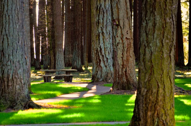
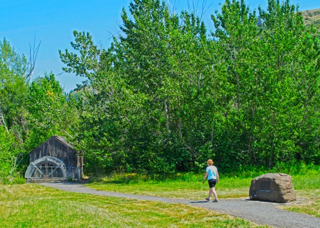
 Many folks like to make their own bodacious “road trip” food. But where do you stop to eat your nutritious nibbles when traveling through an unfamiliar region? How about stopping at one of OTE’s park-like settings featuring towering Douglas fir trees as a natural canopy. Or perhaps a stroll along one of the Columbia Gorge rest area mini-trails after lunch is your thing. While most of our rest areas have picnic areas, the list below shows several across the state with stand out features that make you want to return again:
 -
- Memaloose Rest Area, I-84 (Milepost 73): Hiking trails with stunning views of the Columbia River is a photographer’s paradise. Trails lead back across 31 acres of wooded and open bluffs.
-
- Dead Man Pass Rest Area, I-84 (Milepost 228.9): High in the Blue Mountains, both east and westbound sides feature picnic tables where travelers may contemplate butterflies, tender flora, and bask in warm sunny weather. There’s also an RV Dump Station for those that travel with their home away from home.
- Tillamook Rest Area, Hwy 101 (Milepost 70): Just south of Tillamook and the land of cheese, lies the Tillamook Rest Area, a tiny paradise with winding trails near a rushing creek. Prepare to be wowed by wildlife and even the occasional wedding. It’s true—Tillamook Rest Area is so picturesque that it’s become one of the “it” spots to photograph graduating seniors and even stage weddings. Get your free coffee while you’re there too.
- French Prairie, I-5 (Milepost 281): If trees are your friends, then French Prairie is your BFF. The biggest fattest trunks spiral upwards to a towering canopy of Douglas firs on both sides of the rest area, north and southbound. On the southbound side, the nearly 50 year old Grove of the States features trees sent by the Governor of nearly every state in the Union
- .
- Manzanita Rest Area, I-5 (Milepost 63): The high sunny and warm region of Grants Pass makes a perfect place to stop on your way to, or from, California. Lots of places to stretch your legs, plus scope out pristine picnic and pet areas.
- Solar station Powering the sun’s energy to local residents, the PGE and ODOT solar installation at northbound French Prairie Rest Area (I-5, Milepost 281) is a great place to stop with the family and learn more about large scale solar energy development. A series of interpretive panels and a walking path with native plantings can help untangle car-bound legs.
- Water wheel
 Maybe not quite as exciting as a water slide, but infinitely more educational—the historic water wheel at westbound Charles Reynolds Rest Area (I-84, Milepost 269) is truly unexpected. Where is the rest of the farm or the watering hole that used to exist? Well back in 1866, William N. Banton moved to Oregon with his parents and established a ranch on part of the land that now encompasses the rest stop. Banton built the water wheel in 1911 to power his tool shop and worked the land until 1945.
- Boat ramp Located at the Santiam Rest Area, I-5 (Milepost 241), the ramp to the North Santiam River can be accessed by a rest area service road from either north or southbound sides of the stop. Although the road can be flooded during the rainy season, on most days there is ample room to unload boats or other water craft onto the ramp. Float down-river and enjoy eagle spotting or a bit of fishing. More information about boating access can be obtained by visiting the Trails to Linn County website.
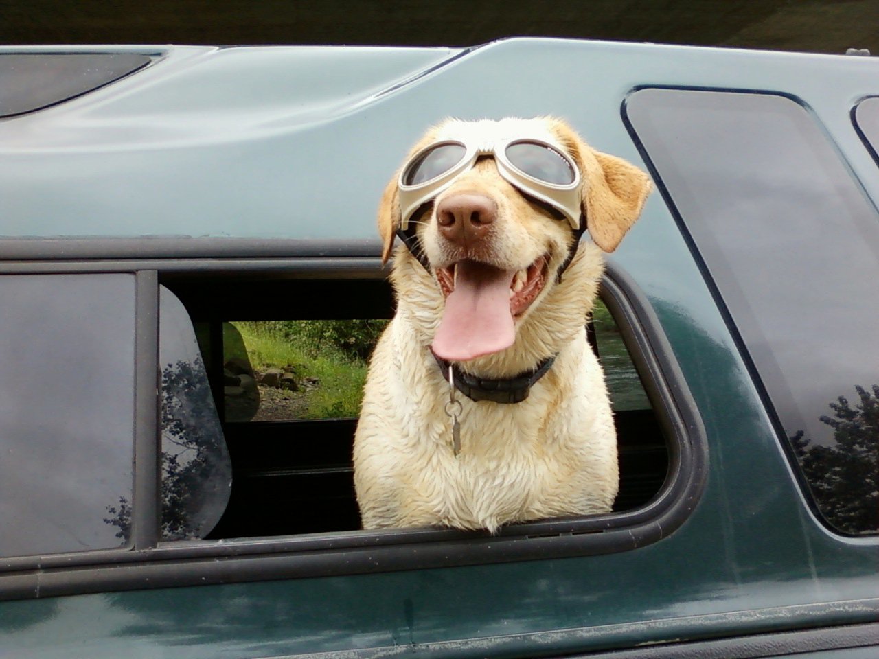
- Pet friendly
 All OTE rest areas welcome the family pet. Be it canine, feline, ferret or parrot. As long as the pet is exercised on a leash, we welcome them to Oregon! One caveat: please clean up any “items” left by your pet (unless they’re trained to flush). To help you keep our rest areas clean for other travelers, we provide recycled pet waste bags in handy dispensers in case you forgot your own. “Pet height” watering fountains can be found in several OTE rest areas.
- Oregon Trail Interpretive Kiosks Oregon was the ultimate destination of many an Oregon Trail pioneer. As a result, pioneer wagon trains traveled over some of the roughest mountain terrain imaginable. Indigenous populations were affected by the new residents, and life was radically changed for many tribes. Since the Oregon Trail wound its way through Eastern Oregon, the Oregon Trail Coordinating Council installed interpretive centers at various rest areas along I-84. You can stop and learn more about regional Oregon Trail history at the following rest areas: Memaloose, Stanfield, Baker Valley, Weatherby, Charles Reynolds, Dead Man Pass, and Ontario.
Oregon rules for rest areas
Public safety and the safe enjoyment of Rest Areas by all visitors is our top priority. You can download the Rest Area Administrative Rules OAR 734 Rest Areas. You can also link directly to the OARs on the State Archives website. OTE maintains a rest area rules web page, where there is a quick summary of all prohibited activities.
Important “Know Before You Go” highway information
 Our friends and partners at the Oregon Department of Transportation (ODOT) want to help you make your travels across our state easy and safe.
With several projects scheduled for this construction season, Oregon highways will be extremely busy. Make sure to check on ODOT’s TripCheck website for any delays or detours in your trip itinerary. Use the interactive maps and web cams to view your route before you go.
Projects on the construction map (provided by ODOT) are listed by highway type and route number. Information is subject to change.
- Download a PDF of the projects map
ODOT asks you to please use caution when driving through work zones. You may encounter traffic restrictions, lane closures, detours and delays. Watch for signs, flaggers and pilot cars to guide you through construction zones. Above all, please drive carefully!
Construction maps are available at ODOT offices, DMV field offices, ports of entry and many travel-related businesses.