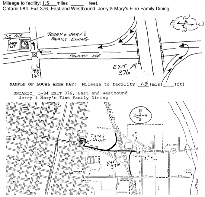
Are you applying to have your logo on a Interstate or Highway Blue Sign? You will need to attach a map to your application.
Essentially, the map you attach must clearly tell us where your business is located in relation to the nearest Interstate / Highway. It should show basic directions from the Interstate or Highway to your business and should clearly indicate the distance that travelers will need to cover from the Interstate or Highway to arrive at your business.
The map sketch is vital in determining the eligibility of signing for your facility. The sketch need not be of engineering grade quality; but it should clearly show the location of the facility, all major intersecting roadways, landmarks, and mileposts as well as the mileage/distance from the bottom of the exit ramp to the facility’s driveway. Also indicate any hills, trees or any other major obstruction that might create a motorist safety problem. The clarity of the map may affect the time needed for the qualification review. Please be as accurate as possible to avoid delays.
After creating your map, please scan it and save it on your computer to be attached at the end of the online application for the sign logo.
Helpful tip: Eight (8) highway skip lines equal 300′
Note that this map example includes a clear sketch as well as a scanned copy of an official map of the area around the business. The map clearly indicates what a motorist would encounter when leaving I-84 to find the restaurant.
